By VERNON ROBISON
Moapa Valley Progress
A bill to increase the acreage of the Moapa River Indian Reservation is still making its way through the process of becoming law. The Moapa Band of Paiutes Land Conveyance Act was originally introduced in the U.S. Senate on August 6, 2015 by Senator Harry Reid (D-Nev.). Reid’s bill would expand the reservation significantly by putting into trust an additional 25,977 acres for the Moapa Band. These lands are currently under the control of the Bureau of Land Management and the Bureau of Reclamation.
“This bill would return a portion of southern Paiute homeland and provide the Moapa Paiutes with space for additional housing, economic development, conservation and cultural protection,” said Reid in a statement last year after the bill was introduced.
Restoring Historic Lands
The size of the Moapa River Indian reservation has been something of a sore spot for tribal members for generations. When it was first established in the 1870s, the reservation spread across 2.5 million acres including much of what today is Moapa, Logandale, Overton, Virgin Valley and the Gold Butte region. In the years following, though, most of that land was stripped away from the tribe, leaving less than 1,500 acres. In 1980, President Jimmy Carter signed a law restoring just over 70,000 additional acres back to the reservation.
“This will be an opportunity for us to get back some of our ancestral land that our people have travelled and traditionally used,” said Moapa Band Chairman Robert Tom in a recent interview with the Progress. “It will also provide some economic development opportunities for the tribe.”
The proposed expansion is divided into four large segments located at various spots bordering the current reservation area.
About 5,700 acres is proposed to be annexed to the northern end of the reservation, near the tribal village area. Flood control is one major reason that the tribe wants to expand into this northern area, Tom said.
He explained that in the major flood of 2014, an old earthen flood control levee had been damaged in an area called White Narrows. The levee is a retention dam, about 20 feet high. It normally holds back the moderate flood waters that run down from the surrounding hills.
“I think that the levee was originally put in there as a CCC project back in the 1930s,” Tom said. “It has been there ever since then and worked just fine holding back the water. We had never seen it get full, maybe a quarter full at most.”
But when the 2014 flood hit, the huge water flow coming from the hills eroded the levee away in spots allowing floodwaters to spread into the fields below and compound flooding problems in the tribal village. Now, the floodwaters coming from that direction are largely unregulated, Tom said.
The problem would be a relatively quick and easy fix. But the levee is located just beyond the reservation boundaries to the north on BLM land.
“Right now, we are still going through FEMA recovery over it,” Tom said. “We want to repair it.”
But repairs would require more than just taking a piece of equipment up to repair the earthen levee, Tom said. It would require a long process. Making changes to the “waters of the U.S.” as this would be, would require approval through the Army Corps of Engineers. The process would be much simpler and quicker if the area were included on the Reservation lands, Tom said.
In addition to the northern expansion, the bill would provide an additional 11,500 acres in a large strip just south of the Paiute Travel Plaza near exit 75. Tom said that this area would be ideal for projects that might bring economic development to the tribe and the surrounding communities.
“We may try to put in more family-oriented things for the public; just like the Moapa Madness event that we just had on July 4,” Tom said. “And it would be a good site for possible industrial projects as well.”
On the western edge of the reservation, nearly 2,000 acres are proposed to be added by the bill. This is near the area where the tribe is currently building a large solar plant. More solar energy projects would be ideal for this area, Tom said. In addition, there are sites of cultural significance to the tribe that are located in the foothills of the mountains in that direction, Tom said.
Finally, around 7,600 acres would be added on the eastern side of the reservation. This would include the Byron exit of Interstate 15. With that exit, as well as a Union Pacific railroad spur in that area, it could be a prime spot for industrial development in the future, Tom said.
Local Concerns Over Access
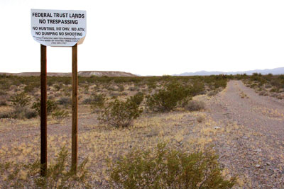
But concerns have been raised about the expansion by various interest groups in the region. These concerns revolve mainly around the uncertainty of access to important sites within, and beyond, the expanded tribal boundaries.
Over the past year, the tribe has expressed a willingness to resolve many of these concerns. For example, last month the tribal council entered a landmark agreement with the Moapa Valley Water District. The agreement will allow the district to retain access and future rights of way across the expanded tribal boundaries to a number of well drilling sites that have been proposed as future water resources for the community.
In addition, Tom said that the tribe is currently in talks with state Department of Wildlife authorities to reach an agreement on access within and across the new tribal boundaries. This would allow teams to monitor wildlife population and infrastructure.
But other local groups and individuals worry that the expansion might curtail, or at least complicate, their recreational access to reach areas where they have traditionally been able to go.
Partners In Conservation administrator Elise McAllister of Moapa points out that there are several important sites that might become more difficult to visit if they fall behind the proposed new reservation boundaries.
One particular example is a spot called Jackass Springs, located out in the desert just west of the Warm Springs area. It is a little known out-of-the-way spot that is a favorite for locals who have gone there for generations. The site would fall within the new reservation boundary.
“There are a lot of families that have traditional, historic and cultural ties to that area,” McAllister said. “It is not well known and its not like you will have hoards of people going there. But families who know about it want to be able to get there. It is an access point for hunting both birds and for big horn sheep. And people should be able to go there.”
There are many other examples of locations with historical and cultural significance to Moapa Valley residents that would fall behind tribal boundaries with the new bill, McAllister said.
For example there are the remnants of an old marker, in the shape of an arrow, that was used to guide U.S. Postal aviators in the early days of air mail delivery. This site is located near the Byron exit. Nearby there is also the foundation of an old service station that once operated along the old highway through the area.
In addition, the old Arrowhead Trail passed through the proposed expansion lands south of the current reservation, McAllister said.
McAllister is also concerned about retaining access through the new boundaries on to the public lands beyond. She talks about areas to the east of the reservation that have typically been accessed from roads at the Byron exit. These areas might become more difficult to get to if one has to cross tribal lands to get there, she said.
“These are all instances of where our culture and our traditional use of the land should be respected and we shouldn’t have to lose that,” McAllister said.
Tom emphasized that the intent of the bill is not to restrict any current access. He expressed an openness to allow the same recreational access as has traditionally been enjoyed on these lands.
“We have no intention to close off access,” he said. “We will still allow people to go up there as they wish.”
But he also stated that the reservation land is considered similar to private land. As such, there are certain procedures that people should follow to be able to travel on or through the reservation, he said. Those procedures involve people contacting the tribal office to get written permission.
“It is like any hunter or any off-road users that are going across private property,” Tom said. “They would have to get permission first from the landowner before they can go across it. That is all we ask.”
Tom explained that people wishing to go on the reservation would need to come to the tribal office and fill out a permission form to allow them access. On the form, the applicants must identify themselves, explain where they will be going, when they will be there, what they will be doing and how long they will be staying, Tom said.
“That just notifies us that somebody is on the reservation,” Tom said. “No one has ever been denied.”
But McAllister says that the requirement to formally register for permission to pass on or through the land is, by nature, a restriction to the traditional land use.
“We have lost a lot in the past years with all of the various restrictions on federal lands” McAllister said. “So we really feel the impact of losing one more road or one more place.”
McAllister said that she is behind economic development for the tribe. But she fears that the current bill takes in far more than is needed for that purpose. What’s more, it unnecessarily places additional restrictions on traditional uses of the land by the public, she said.
“When you talk about expansion, the question really should be: Where is it needed?” McAllister said. “It makes sense to have them get some land up north by their actual community to fix the problems there and allow for community expansion. But the huge swaths of land being included for such small and focused needs just seems like too much.”
Stifling Future Opportunities?
Others view the inclusion of the Byron exit as an obstacle to future economic development. Former Logandale resident, Tony Ricco, who is a real estate broker and regional developer, said that the bill would squash a major opportunity for the future.
Ricco said that he has been working with a group that “may be interested” in procuring a large portion of 28,000 acres of BLM land currently available for disposal along the I-15 on the west side of the I-15, just north of Byron.
Ricco admits that the project could be decades away. Currently there is no power or water service to that area. Still, with an industrial project of that magnitude, a developer might make enough money back on the project to justify the investment, Ricco said.
But restricted access to the Byron exit would be a complete dealbreaker for the project, he said.
“Byron would be everything,” Ricco said. “Without it the rest of the deal would make no sense.”
The loss of such a project would be a huge detriment to the local and state economy, Ricco said. “Even if the property wasn’t developed for 30 years, like Apex, it would be taxed with property taxes. There would be a business that could help pay for public schools and other state services.”
Ricco is certain that if an economic impact analysis was done on the affect of the bill to the state of Nevada, it would find that the state would get no benefit and all detriment from it.
“It would be a negative economic legacy to the state of Nevada in perpetuity,” Ricco said. “I can’t stress how poignant and true that statement is.”